A recent simulation led by BMT and the UK Hydrographic Office demonstrates how combining marine geospatial datasets with advanced modelling tools can support autonomous vessel navigation in complex port environments.
Navigating busy ports and intricate waterways presents significant challenges for vessel operators, particularly when aiming to reduce human error and improve operational safety. Autonomous navigation systems seek to address these challenges by integrating diverse data sources to provide real-time situational awareness and decision support. A recent case study involving BMT and the UK Hydrographic Office (UKHO) offers a detailed example of how this integration can be achieved and tested.
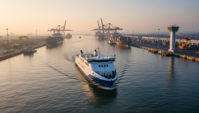
The UKHO’s Admiralty Marine Innovation Programme recently held a challenge focused on autonomous navigation technology. BMT was selected as the winner for their system that combines advanced simulation software with comprehensive Admiralty marine geospatial data. The system was demonstrated in a simulation where a 140-meter part-autonomous ferry navigated Plymouth port, adapting dynamically to environmental conditions and traffic.
At the core of BMT’s approach is the integration of multiple data types essential for safe navigation. These include bathymetry (underwater topography), tidal streams, seabed composition, and established ship routing information. This geospatial data is combined with real-time inputs from satellite sources and Automatic Identification System (AIS) receivers, which track vessel movements. The simulation tools used—Rembrandt and Tuflow—allow detailed modelling of the marine environment and vessel behavior under varying conditions.
This integration is critical because it enables the autonomous system to maintain situational awareness in a complex and dynamic environment. For example, tidal streams affect vessel maneuverability, while seabed composition influences safe navigation zones. AIS data provides information on other vessels’ positions and movements, allowing the system to anticipate and avoid potential collisions. Satellite data supplements these inputs, offering broader environmental context.
The Plymouth port simulation demonstrated the system’s ability to process these diverse data streams and adjust the ferry’s route in real time. However, it is important to note that this capability has so far been validated in a simulated environment. The development of an operational autonomous navigation product tailored for real-world deployment remains ongoing, with further refinement expected through collaboration between BMT and the UKHO. BMT’s participation in the IoT Tribe Space Endeavour Accelerator aims to enhance the system’s use of satellite-derived data, reflecting the increasing role of space-based assets in maritime applications.
Beyond this specific project, the maritime industry is seeing growing interest in autonomous technologies. For instance, Greek companies have recently partnered to develop unmanned autonomous surface vessels, combining shipbuilding expertise with artificial intelligence and advanced marine manufacturing techniques. These efforts indicate a broader trend toward exploring autonomous operations in various maritime sectors.
The UKHO’s Admiralty Marine Innovation Programme also plans to address other maritime challenges, including renewable energy generation, blue carbon sequestration, and sea-level rise modelling. These initiatives highlight the strategic use of geospatial data and modelling tools to support sustainable ocean management.
For marine engineers, shipyard managers, port authorities, and vessel operators, developments like the BMT/UKHO autonomous navigation system illustrate the technical complexity involved in integrating multiple data sources and simulation tools. Such systems must accurately represent environmental conditions and vessel dynamics to support safe navigation decisions. While fully autonomous operations are still under development, these projects provide valuable insights into the engineering challenges and potential applications of autonomous navigation technology.